Taking the world by storm.
Our Products
Sleek & user-friendly tools for weather enthusiasts.
SatSquatch
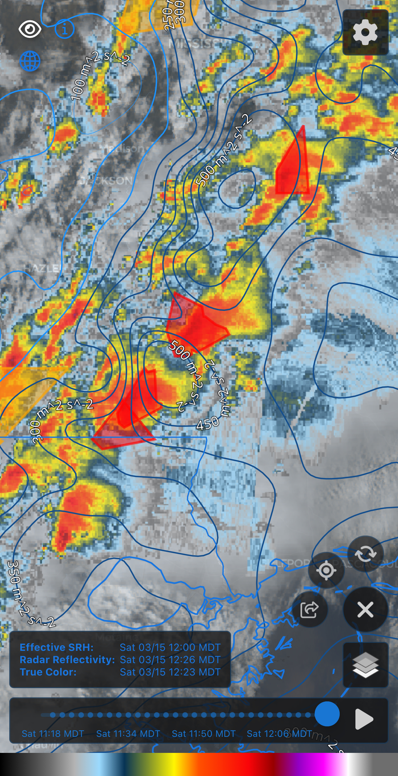
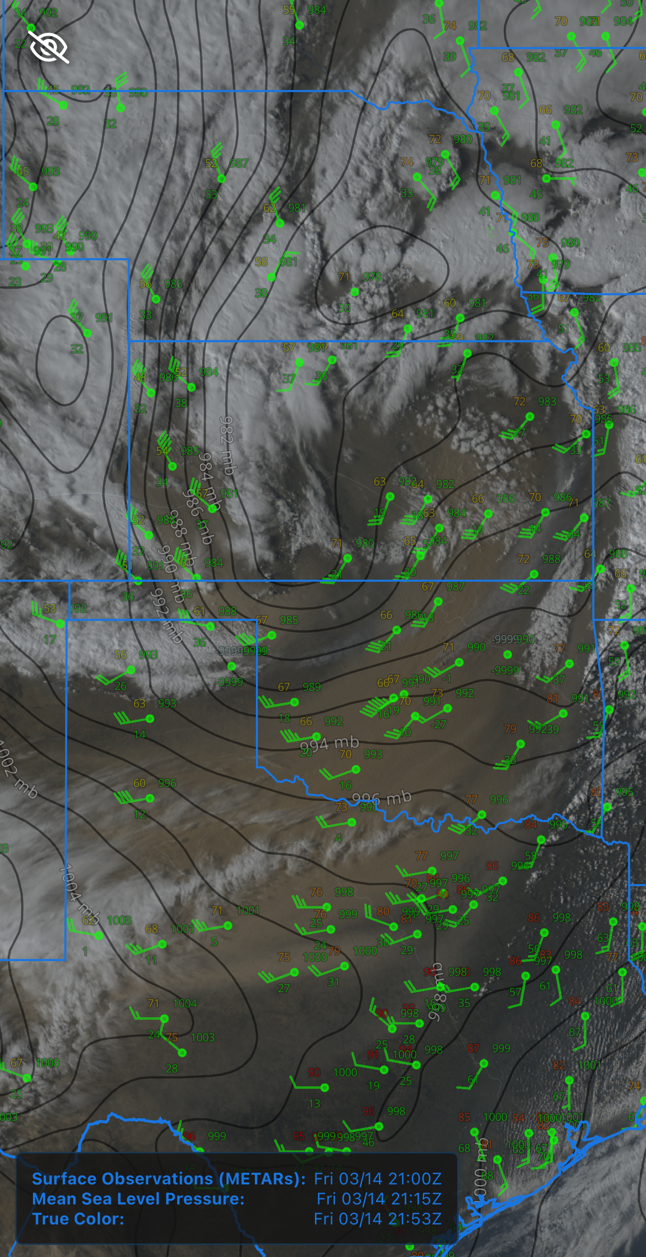
Custom maps with GOES satellite, mesoanalysis, MRMS, and more!
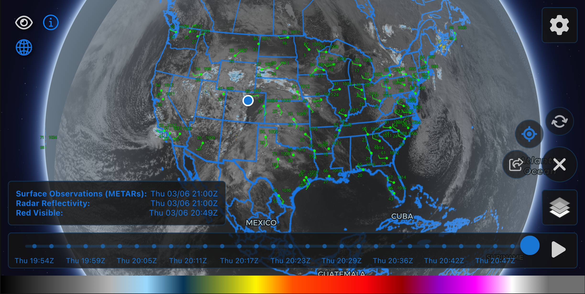
SatSquatch's intuitive interface provides powerful weather visualization tools in a user-friendly package.
Explore SatSquatch
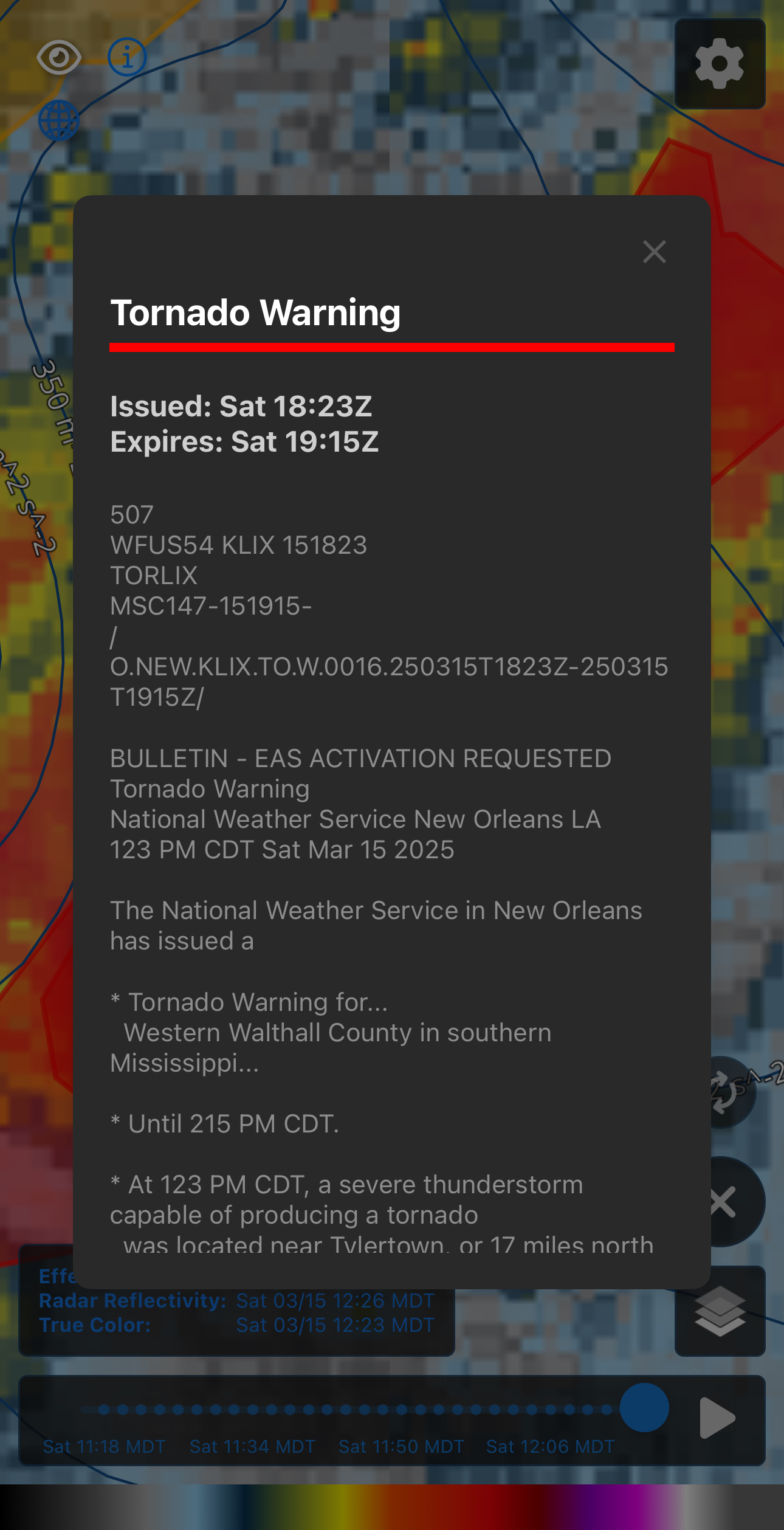
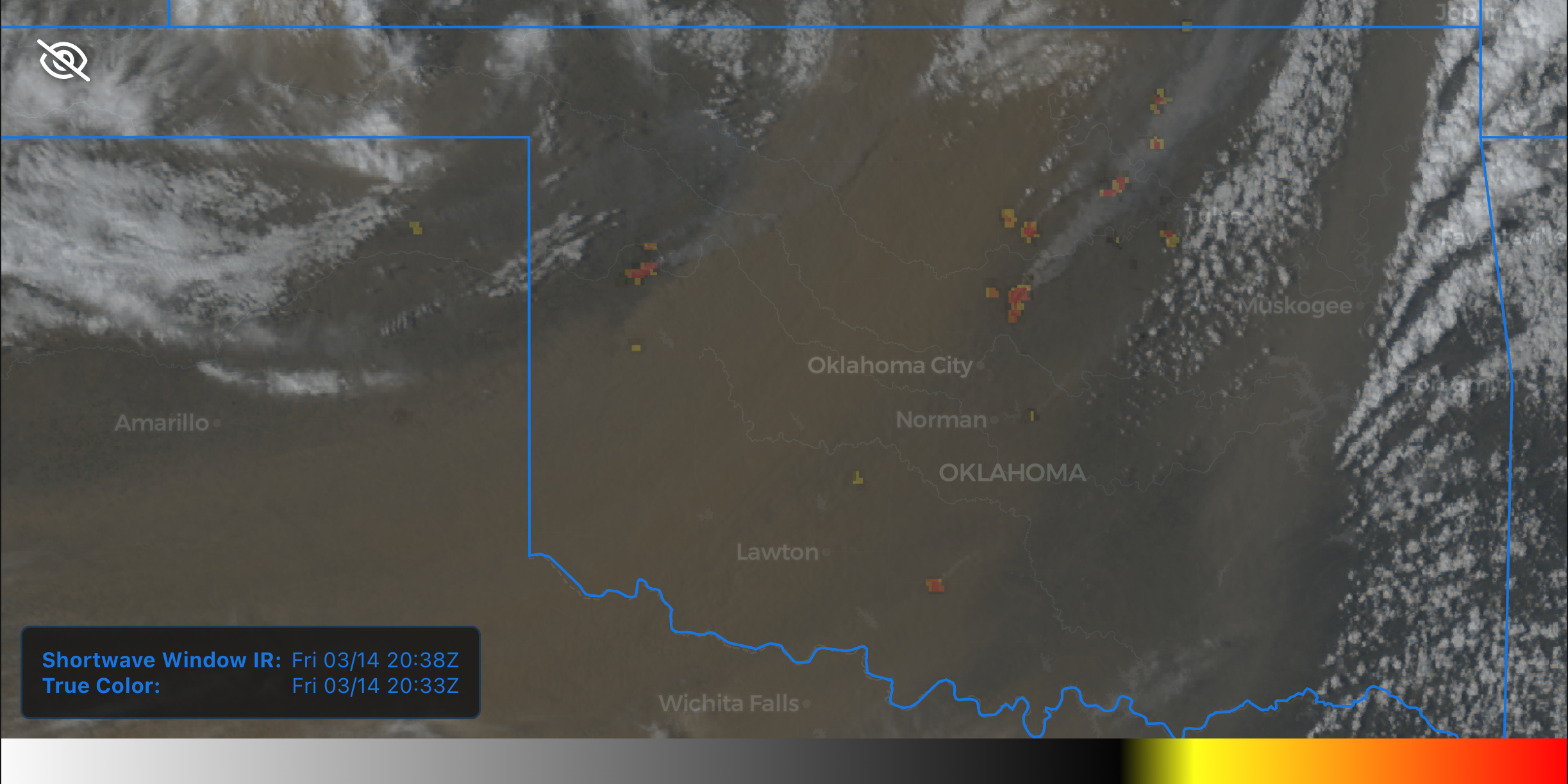
Access real-time, high-resolution GOES satellite imagery. Track storm development, atmospheric conditions, wildfires, and more with unprecedented clarity & ease.
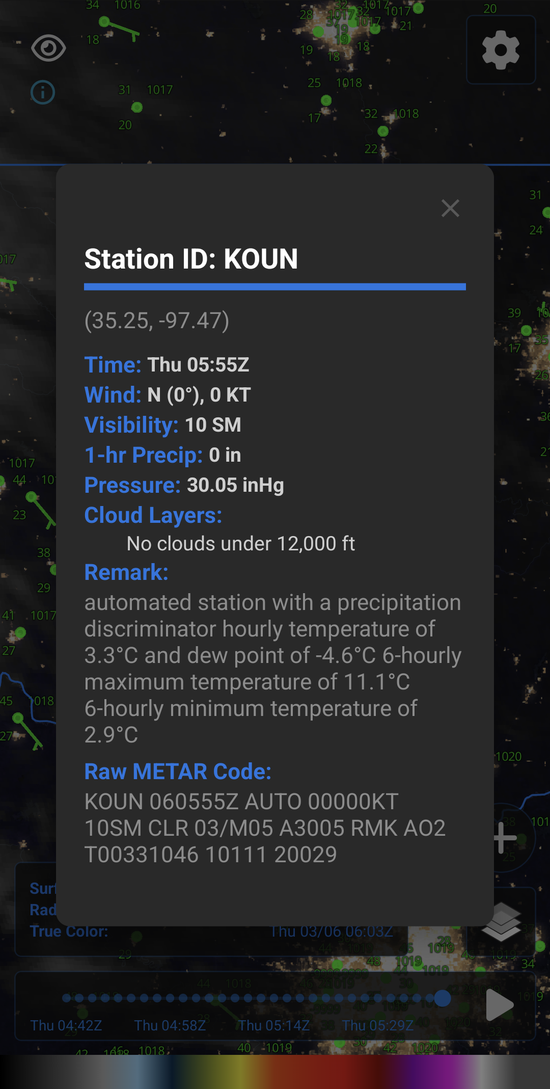
Analyze current meteorological conditions with our suite of mesoanalysis & observation products. Visualize METARS, CAPE, shear, and other critical parameters for weather forecasting.
Build and save custom colormaps for vector and contour data. Tailor your data visualizations to match your unique analysis needs for any scenario.
Layer radar products on your custom maps for comprehensive storm analysis. Combine with satellite imagery for complete situational awareness.
Frequently Asked Questions
We produce high-resolution, 15-minute mesoanalysis products for CONUS by combining RTMA surface data with HRRR vertical levels using GPU-accelerated software.
Yes, SatSquatch is designed specifically for tracking storms and other weather phenomena. By combining GOES satellite imagery, MRMS data, and mesoanalysis tools, SatSquatch provides all the resources needed for accurate storm tracking and analysis in one intuitive platform.
Yes, SatSquatch has multiple data layers and tools specifically designed for tracking wildfires such as IR satellite imagery, hotspot detection, mesoanalysis tools, and more.
Yes, SatSquatch is available as a mobile app for both iOS and Android devices, as well as a web application. This allows you to access professional-grade weather data and visualization tools anywhere, anytime.
Gallery
Our Team
We're passionate about weather (and neat ways to visualize it).
Austin King
CEO & Frontend developer
Kelton Halbert
Co-lead backend developer
Andrew Lyons
CFO & Lead Meteorologist
Tyler Bell
Co-lead backend developer